


Collins Handy Road Atlas Scotland
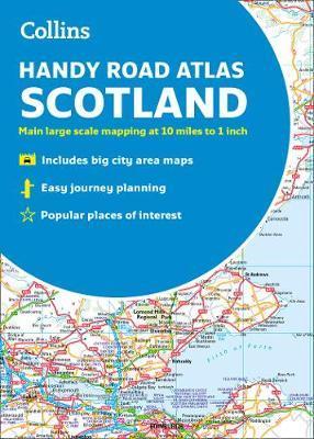
Collins Handy Road Atlas Scotland
Main features of this atlas include:
Clear, attractive route planning maps of the whole of Scotland supported by comprehensive, fully indexed city centre street maps of Aberdeen, Dundee, Edinburgh, Glasgow, Inverness and Perth.
Scale of main maps: 1:625,000 (9.9 miles to 1 inch).
Also includes:
* Places of tourist interest are highlighted
* Has attractive layer colouring showing land height
* Road network fully classified and colour coded
* Detailed street mapping of Edinburgh, including the Royal Mile with all its attractions clearly marked, Leith and Holyrood Park
* Detailed street mapping of Glasgow, including the West End, city centre and M74 extension
* Detailed street mapping of Aberdeen, including the bypass
* Street maps, with indexes, of Dundee, Inverness and Perth city centres
* Handy distance calculator chart highlighting distances between the major towns
* Administrative areas map showing council areas
* Transport connections section listing all the airports and details of all vehicle ferries into and within Scotland
Area of coverage:
Covers the whole of Scotland and part of northern England, extending down to Kendal and Scarborough in the south.
PRP: 33.86 Lei
Acesta este Pretul Recomandat de Producator. Pretul de vanzare al produsului este afisat mai jos.
30.47Lei
30.47Lei
33.86 LeiPrimesti 30 puncte

Indisponibil
Descrierea produsului
Main features of this atlas include:
Clear, attractive route planning maps of the whole of Scotland supported by comprehensive, fully indexed city centre street maps of Aberdeen, Dundee, Edinburgh, Glasgow, Inverness and Perth.
Scale of main maps: 1:625,000 (9.9 miles to 1 inch).
Also includes:
* Places of tourist interest are highlighted
* Has attractive layer colouring showing land height
* Road network fully classified and colour coded
* Detailed street mapping of Edinburgh, including the Royal Mile with all its attractions clearly marked, Leith and Holyrood Park
* Detailed street mapping of Glasgow, including the West End, city centre and M74 extension
* Detailed street mapping of Aberdeen, including the bypass
* Street maps, with indexes, of Dundee, Inverness and Perth city centres
* Handy distance calculator chart highlighting distances between the major towns
* Administrative areas map showing council areas
* Transport connections section listing all the airports and details of all vehicle ferries into and within Scotland
Area of coverage:
Covers the whole of Scotland and part of northern England, extending down to Kendal and Scarborough in the south.
Detaliile produsului
De pe acelasi raft
-

PRP: 154.94 Lei
139.45 Lei
139.45 Lei154.94 Lei
-
PRP: 154.93 Lei
139.44 Lei
139.44 Lei154.93 Lei
-
PRP: 123.69 Lei
111.32 Lei
111.32 Lei123.69 Lei
-
PRP: 61.06 Lei
54.95 Lei
54.95 Lei61.06 Lei
-
PRP: 123.69 Lei
111.32 Lei
111.32 Lei123.69 Lei
-
PRP: 123.94 Lei
111.55 Lei
111.55 Lei123.94 Lei
-
PRP: 105.09 Lei
94.58 Lei
94.58 Lei105.09 Lei
-
PRP: 102.97 Lei
92.67 Lei
92.67 Lei102.97 Lei
-
PRP: 92.94 Lei
83.65 Lei
83.65 Lei92.94 Lei
-
PRP: 123.69 Lei
111.32 Lei
111.32 Lei123.69 Lei
-
PRP: 274.38 Lei
246.94 Lei
246.94 Lei274.38 Lei
-
PRP: 154.69 Lei
139.22 Lei
139.22 Lei154.69 Lei
-
PRP: 61.06 Lei
54.95 Lei
54.95 Lei61.06 Lei
De acelasi autor
-
PRP: 111.29 Lei
100.16 Lei
100.16 Lei111.29 Lei
-
PRP: 154.69 Lei
139.22 Lei
139.22 Lei154.69 Lei
-
PRP: 154.69 Lei
139.22 Lei
139.22 Lei154.69 Lei
-
PRP: 105.09 Lei
94.58 Lei
94.58 Lei105.09 Lei
-
PRP: 55.73 Lei
50.16 Lei
50.16 Lei55.73 Lei
-
PRP: 204.29 Lei
183.86 Lei
183.86 Lei204.29 Lei
-
PRP: 55.48 Lei
49.93 Lei
49.93 Lei55.48 Lei
-
PRP: 247.69 Lei
222.92 Lei
222.92 Lei247.69 Lei
