


Rand McNally Chicago, Illinois Street Map
Rand McNally Chicago, Illinois Street Map
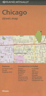
Rand McNally's folded map for Chicago is a must-have for anyone traveling in and around this part of Illinois, offering unbeatable accuracy and reliability at a great price. Our trusted cartography shows all Interstate, U.S., state, and county highways, along with clearly indicated parks, points of interest, airports, county boundaries, and streets. The easy-to-use legend and detailed index make for quick and easy location of destinations. You'll see why Rand McNally folded maps have been the trusted standard for years.
Regularly updated
Full-color maps
Clearly labeled Interstate, U.S., state, and county highways
Indications of parks, points of interest, airports, county boundaries, schools, shopping malls, downtown & vicinity maps
Easy-to-use legend
Detailed & full street index
Convenient folded size
Coverage Area
Communities Included: Berwyn, Bridgeview, Brookfield, Burbank, Cicero, Elmwood Park, Evergreen Park, Franklin Park, La Grange, Lyons, Oak Lawn, Oak Park, Riverside, Willow Springs plus downtown enlargement map
Product Details
Measures 9.5' x 4' and folds out to 40' x 28'.
1 inch represents approximately 0.5 miles, or 1:31,680
PRP: 43.33 Lei
Acesta este Pretul Recomandat de Producator. Pretul de vanzare al produsului este afisat mai jos.
39.00Lei
39.00Lei
43.33 LeiPrimesti 38 puncte

Indisponibil
Descrierea produsului
Rand McNally's folded map for Chicago is a must-have for anyone traveling in and around this part of Illinois, offering unbeatable accuracy and reliability at a great price. Our trusted cartography shows all Interstate, U.S., state, and county highways, along with clearly indicated parks, points of interest, airports, county boundaries, and streets. The easy-to-use legend and detailed index make for quick and easy location of destinations. You'll see why Rand McNally folded maps have been the trusted standard for years.
Regularly updated
Full-color maps
Clearly labeled Interstate, U.S., state, and county highways
Indications of parks, points of interest, airports, county boundaries, schools, shopping malls, downtown & vicinity maps
Easy-to-use legend
Detailed & full street index
Convenient folded size
Coverage Area
Communities Included: Berwyn, Bridgeview, Brookfield, Burbank, Cicero, Elmwood Park, Evergreen Park, Franklin Park, La Grange, Lyons, Oak Lawn, Oak Park, Riverside, Willow Springs plus downtown enlargement map
Product Details
Measures 9.5' x 4' and folds out to 40' x 28'.
1 inch represents approximately 0.5 miles, or 1:31,680
Detaliile produsului
De pe acelasi raft
-

PRP: 69.67 Lei
62.70 Lei
62.70 Lei69.67 Lei
-
PRP: 161.20 Lei
145.08 Lei
145.08 Lei161.20 Lei
-
PRP: 154.61 Lei
139.15 Lei
139.15 Lei154.61 Lei
-
PRP: 74.65 Lei
67.19 Lei
67.19 Lei74.65 Lei
-
PRP: 123.69 Lei
111.32 Lei
111.32 Lei123.69 Lei
-
PRP: 216.69 Lei
195.02 Lei
195.02 Lei216.69 Lei
-
PRP: 263.11 Lei
236.80 Lei
236.80 Lei263.11 Lei
-
PRP: 247.61 Lei
222.85 Lei
222.85 Lei247.61 Lei
-
PRP: 163.37 Lei
147.03 Lei
147.03 Lei163.37 Lei
-
PRP: 92.93 Lei
83.64 Lei
83.64 Lei92.93 Lei
-
PRP: 294.11 Lei
264.70 Lei
264.70 Lei294.11 Lei
-
PRP: 154.69 Lei
139.22 Lei
139.22 Lei154.69 Lei
-
PRP: 247.69 Lei
222.92 Lei
222.92 Lei247.69 Lei
-
PRP: 92.93 Lei
83.64 Lei
83.64 Lei92.93 Lei
-
PRP: 54.17 Lei
48.75 Lei
48.75 Lei54.17 Lei
-
PRP: 56.11 Lei
50.50 Lei
50.50 Lei56.11 Lei
-
PRP: 132.45 Lei
119.20 Lei
119.20 Lei132.45 Lei
De acelasi autor
-
PRP: 55.74 Lei
50.17 Lei
50.17 Lei55.74 Lei
-
PRP: 55.73 Lei
50.16 Lei
50.16 Lei55.73 Lei
-
PRP: 185.69 Lei
167.12 Lei
167.12 Lei185.69 Lei
-
PRP: 185.69 Lei
167.12 Lei
167.12 Lei185.69 Lei
-
PRP: 72.26 Lei
65.03 Lei
65.03 Lei72.26 Lei
-
PRP: 180.47 Lei
162.42 Lei
162.42 Lei180.47 Lei
-
PRP: 72.26 Lei
65.03 Lei
65.03 Lei72.26 Lei
-
PRP: 247.69 Lei
222.92 Lei
222.92 Lei247.69 Lei
-
PRP: 72.26 Lei
65.03 Lei
65.03 Lei72.26 Lei
-
PRP: 50.56 Lei
45.50 Lei
45.50 Lei50.56 Lei
-
PRP: 80.54 Lei
72.49 Lei
72.49 Lei80.54 Lei
