


World & U.S. Map
World & U.S. Map
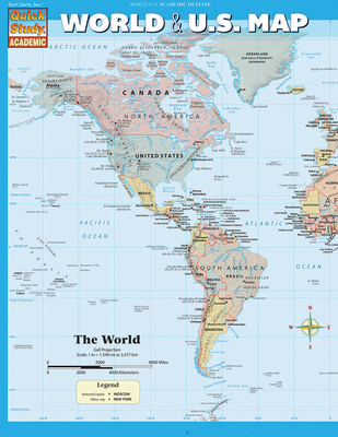
Most up-to-date, inexpensive, durable and beautiful maps of the World and the United States available anywhere. This handy notebook sized laminated map folds out to 11 by 17 inches with the World on one side and the U.S. on the other, plus an additional page of World & U.S. statistics and trivia for each map. A scaled down replica and companion to our 50 by 32 inch wall poster map with as much info as could be retained on this smaller size. Perfect for students of all ages and anyone interested in expanding their knowledge of the United States and the World. *Classroom bonus - the large wall map can be used for the whole class while students reference their individual maps at their desks (lamination makes for durable classroom sets).
Guide Includes:
- United States map
- Satellite imaged topography of the U.S.
- States & state capitals
- Cities labeled by human population
- National parks & preserves
- Man-made waterways, swamps & marshlands
- Time zone boundaries
- World map
- National capitals & large cities
- Satellite imaged topography of the World
- Distance & scale
- Extremely detailed boundaries and coastlines
PRP: 59.33 Lei
Acesta este Pretul Recomandat de Producator. Pretul de vanzare al produsului este afisat mai jos.
47.46Lei
47.46Lei
59.33 LeiPrimesti 47 puncte

Indisponibil
Descrierea produsului
Most up-to-date, inexpensive, durable and beautiful maps of the World and the United States available anywhere. This handy notebook sized laminated map folds out to 11 by 17 inches with the World on one side and the U.S. on the other, plus an additional page of World & U.S. statistics and trivia for each map. A scaled down replica and companion to our 50 by 32 inch wall poster map with as much info as could be retained on this smaller size. Perfect for students of all ages and anyone interested in expanding their knowledge of the United States and the World. *Classroom bonus - the large wall map can be used for the whole class while students reference their individual maps at their desks (lamination makes for durable classroom sets).
Guide Includes:
- United States map
- Satellite imaged topography of the U.S.
- States & state capitals
- Cities labeled by human population
- National parks & preserves
- Man-made waterways, swamps & marshlands
- Time zone boundaries
- World map
- National capitals & large cities
- Satellite imaged topography of the World
- Distance & scale
- Extremely detailed boundaries and coastlines
Detaliile produsului
De pe acelasi raft
-

PRP: 135.86 Lei
108.69 Lei
108.69 Lei135.86 Lei
-
PRP: 80.53 Lei
64.42 Lei
64.42 Lei80.53 Lei
-
Lethal Tides: Mary Sears and the Marine Scientists Who Helped Win World War II - Catherine Musemeche
PRP: 179.73 Lei
143.78 Lei
143.78 Lei179.73 Lei
-
PRP: 82.58 Lei
66.06 Lei
66.06 Lei82.58 Lei
-
PRP: 99.12 Lei
79.30 Lei
79.30 Lei99.12 Lei
-
PRP: 153.00 Lei
122.40 Lei
122.40 Lei153.00 Lei
-
PRP: 142.54 Lei
114.03 Lei
114.03 Lei142.54 Lei
-
PRP: 142.54 Lei
114.03 Lei
114.03 Lei142.54 Lei
-
PRP: 123.69 Lei
98.95 Lei
98.95 Lei123.69 Lei
-
PRP: 222.89 Lei
178.31 Lei
178.31 Lei222.89 Lei
-
PRP: 146.27 Lei
117.02 Lei
117.02 Lei146.27 Lei
-
PRP: 136.40 Lei
109.12 Lei
109.12 Lei136.40 Lei
-
PRP: 75.00 Lei
60.00 Lei
60.00 Lei75.00 Lei
-
PRP: 86.03 Lei
68.82 Lei
68.82 Lei86.03 Lei
