








- /
- Librarie online
- /
- Carti in engleza
- /
- Reference
- /
- Genealogy & Heraldry
- /
- Irish Emigration Lists, 1833-1839 - Brian Mitchell
Irish Emigration Lists, 1833-1839
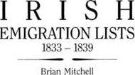
Irish Emigration Lists, 1833-1839
The purpose of the Ordnance Survey of Ireland was to map the whole country at a scale of six inches to one mile, and the six-inch maps appeared between 1835 and 1846. Each map was to have been accompanied by topographical descriptions, or memoirs, for every civil parish, but this was impractical, and the idea was abandoned. However, the field officers gathered much useful data, and the notebooks in which the information was recorded are now in the Royal Irish Academy in Dublin. They cover nineteen of Ireland's thirty-two counties, though the memoirs of Antrim and Londonderry are the only ones with lists of emigrants. These lists have been extracted, arranged under parish, and alphabetized, and they identify the emigrant's destination and his place of origin in Ireland--key pieces of information for anyone tracing his Irish ancestry. In addition, the age, town and address, year of emigration, and religious denomination are given for each emigrant. Over 3,000 emigrants are identified in this book.
PRP: 222.79 Lei

Acesta este Prețul Recomandat de Producător. Prețul de vânzare al produsului este afișat mai jos.
200.51Lei
200.51Lei
222.79 LeiPrimești 200 puncte

Livrare in 2-4 saptamani
Descrierea produsului
The purpose of the Ordnance Survey of Ireland was to map the whole country at a scale of six inches to one mile, and the six-inch maps appeared between 1835 and 1846. Each map was to have been accompanied by topographical descriptions, or memoirs, for every civil parish, but this was impractical, and the idea was abandoned. However, the field officers gathered much useful data, and the notebooks in which the information was recorded are now in the Royal Irish Academy in Dublin. They cover nineteen of Ireland's thirty-two counties, though the memoirs of Antrim and Londonderry are the only ones with lists of emigrants. These lists have been extracted, arranged under parish, and alphabetized, and they identify the emigrant's destination and his place of origin in Ireland--key pieces of information for anyone tracing his Irish ancestry. In addition, the age, town and address, year of emigration, and religious denomination are given for each emigrant. Over 3,000 emigrants are identified in this book.
Detaliile produsului