


- /
- Librarie online
- /
- Carti in engleza
- /
- Games & Activites
- /
- Coloring Books
- /
- World Regional Maps Coloring Book: Maps of World Regions, Continents, World Projections, USA and Canada - J. Bruce Jones
World Regional Maps Coloring Book: Maps of World Regions, Continents, World Projections, USA and Canada
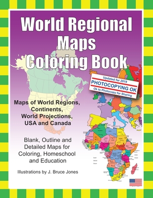
World Regional Maps Coloring Book: Maps of World Regions, Continents, World Projections, USA and Canada
World Regional Maps Coloring Book, updated for 2019. Learn and color blank, outline maps of the world and its regions. World Regions Coloring Book with blank outline maps is great for learning world regional geography, coloring, homeschool, and education. Each blank, outline, printable continent map is presented with a detailed version with political borders, country, capitals, major city names and country name, and then an outline map with just country names and a blank outline map without any of the information, great to color however you want. Students can trace the outlines of the map, study and highlight continents and features on the blank map. A great resource for students and teachers. Black outline blank world maps included in the coloring book are:
- World Maps - Robinson Projection
- World Maps - Mercator Projection
- United States Outline Maps, with and without names
- Canada Maps, with and without names World Regional and Continent Maps:
- Africa Map
- Asia Map
- Australia, Oceania Map
- Australia Map
- Europe Map
- Maps of North America including Canada, USA and Mexico
- South America
- Antarctica Map Additional world regions maps included are: - Russia Map
- Central America and the Caribbean Map
- Central America Map
- Europe to the Ural Mountains Map
- Eastern Europe Map
- Eastern Europe - Balken Regional Map
- Middle East Map
- Mediterranean Regional Map
- Latin America Map
- Scandinavia Map
- Southeast Asia Map Maps come with and in a blank version without names The printable, blank, outline regional maps in this coloring book can be freely photocopied by a teacher or parent for use in a classroom or for homeschool lessons.
PRP: 86.03 Lei
Acesta este Prețul Recomandat de Producător. Prețul de vânzare al produsului este afișat mai jos.
77.43Lei
77.43Lei
86.03 LeiPrimești 77 puncte
Livrare in 2-4 saptamani
Descrierea produsului
World Regional Maps Coloring Book, updated for 2019. Learn and color blank, outline maps of the world and its regions. World Regions Coloring Book with blank outline maps is great for learning world regional geography, coloring, homeschool, and education. Each blank, outline, printable continent map is presented with a detailed version with political borders, country, capitals, major city names and country name, and then an outline map with just country names and a blank outline map without any of the information, great to color however you want. Students can trace the outlines of the map, study and highlight continents and features on the blank map. A great resource for students and teachers. Black outline blank world maps included in the coloring book are:
- World Maps - Robinson Projection
- World Maps - Mercator Projection
- United States Outline Maps, with and without names
- Canada Maps, with and without names World Regional and Continent Maps:
- Africa Map
- Asia Map
- Australia, Oceania Map
- Australia Map
- Europe Map
- Maps of North America including Canada, USA and Mexico
- South America
- Antarctica Map Additional world regions maps included are: - Russia Map
- Central America and the Caribbean Map
- Central America Map
- Europe to the Ural Mountains Map
- Eastern Europe Map
- Eastern Europe - Balken Regional Map
- Middle East Map
- Mediterranean Regional Map
- Latin America Map
- Scandinavia Map
- Southeast Asia Map Maps come with and in a blank version without names The printable, blank, outline regional maps in this coloring book can be freely photocopied by a teacher or parent for use in a classroom or for homeschool lessons.
Detaliile produsului