


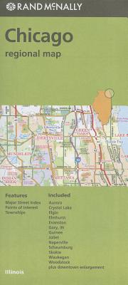
Chicago Regional Map
Chicago Regional Map
Rand McNally's folded map for Chicago is a must-have for anyone traveling in and around this part of Illinois, offering unbeatable accuracy and reliability at a great price. Our trusted cartography shows all Interstate, U.S., state, and county highways, along with clearly indicated parks, points of interest, airports, county boundaries, and streets. The easy-to-use legend and detailed index make for quick and easy location of destinations. You'll see why Rand McNally folded maps have been the trusted standard for years.
Full-color maps
Clearly labeled Interstate, U.S., state, and county highways
Indications of parks, points of interest, airports, county boundaries, downtown & vicinity maps
Major attractions & Golf Courses
Easy-to-use legend
Detailed index & Major Street Index
Coverage Area
Communities Included: Aurora, Crystal Lake, Elgin, Elmhurst, Evanston, Gary, IN, Gurnee, Joliet, Naperville, Schaumburg, Skokie, Waukegan, Woodstock plus downtown enlargement
Product Details
Measures 9.5' x 4' and folds out to 40' x 28'.
PRP: 50.56 Lei
Acesta este Pretul Recomandat de Producator. Pretul de vanzare al produsului este afisat mai jos.
45.50Lei
45.50Lei
50.56 LeiPrimesti 45 puncte

Indisponibil
Descrierea produsului
Rand McNally's folded map for Chicago is a must-have for anyone traveling in and around this part of Illinois, offering unbeatable accuracy and reliability at a great price. Our trusted cartography shows all Interstate, U.S., state, and county highways, along with clearly indicated parks, points of interest, airports, county boundaries, and streets. The easy-to-use legend and detailed index make for quick and easy location of destinations. You'll see why Rand McNally folded maps have been the trusted standard for years.
Full-color maps
Clearly labeled Interstate, U.S., state, and county highways
Indications of parks, points of interest, airports, county boundaries, downtown & vicinity maps
Major attractions & Golf Courses
Easy-to-use legend
Detailed index & Major Street Index
Coverage Area
Communities Included: Aurora, Crystal Lake, Elgin, Elmhurst, Evanston, Gary, IN, Gurnee, Joliet, Naperville, Schaumburg, Skokie, Waukegan, Woodstock plus downtown enlargement
Product Details
Measures 9.5' x 4' and folds out to 40' x 28'.
Detaliile produsului
De pe acelasi raft
-

PRP: 154.69 Lei
139.22 Lei
139.22 Lei154.69 Lei
-
PRP: 154.61 Lei
139.15 Lei
139.15 Lei154.61 Lei
-
PRP: 270.86 Lei
243.77 Lei
243.77 Lei270.86 Lei
-
PRP: 263.11 Lei
236.80 Lei
236.80 Lei263.11 Lei
-
PRP: 263.11 Lei
236.80 Lei
236.80 Lei263.11 Lei
-
PRP: 247.61 Lei
222.85 Lei
222.85 Lei247.61 Lei
-
PRP: 270.86 Lei
243.77 Lei
243.77 Lei270.86 Lei
-
PRP: 263.11 Lei
236.80 Lei
236.80 Lei263.11 Lei
-
PRP: 136.40 Lei
122.76 Lei
122.76 Lei136.40 Lei
-
PRP: 294.11 Lei
264.70 Lei
264.70 Lei294.11 Lei
-
PRP: 263.11 Lei
236.80 Lei
236.80 Lei263.11 Lei
-
PRP: 216.69 Lei
195.02 Lei
195.02 Lei216.69 Lei
-
PRP: 247.69 Lei
222.92 Lei
222.92 Lei247.69 Lei
-
PRP: 92.93 Lei
83.64 Lei
83.64 Lei92.93 Lei
-
PRP: 163.37 Lei
147.03 Lei
147.03 Lei163.37 Lei
-
PRP: 203.49 Lei
183.14 Lei
183.14 Lei203.49 Lei
-
PRP: 69.67 Lei
62.70 Lei
62.70 Lei69.67 Lei
-
PRP: 56.11 Lei
50.50 Lei
50.50 Lei56.11 Lei
-
PRP: 161.20 Lei
145.08 Lei
145.08 Lei161.20 Lei
De acelasi autor
-
PRP: 55.74 Lei
50.17 Lei
50.17 Lei55.74 Lei
-
PRP: 185.69 Lei
167.12 Lei
167.12 Lei185.69 Lei
-
PRP: 185.69 Lei
167.12 Lei
167.12 Lei185.69 Lei
-
PRP: 185.69 Lei
167.12 Lei
167.12 Lei185.69 Lei
-
PRP: 65.03 Lei
58.53 Lei
58.53 Lei65.03 Lei
-
PRP: 72.26 Lei
65.03 Lei
65.03 Lei72.26 Lei
-
PRP: 180.47 Lei
162.42 Lei
162.42 Lei180.47 Lei
-
PRP: 247.69 Lei
222.92 Lei
222.92 Lei247.69 Lei
-
PRP: 72.26 Lei
65.03 Lei
65.03 Lei72.26 Lei
-
PRP: 72.26 Lei
65.03 Lei
65.03 Lei72.26 Lei
-
PRP: 50.56 Lei
45.50 Lei
45.50 Lei50.56 Lei
-
PRP: 80.54 Lei
72.49 Lei
72.49 Lei80.54 Lei
