


Delorme Atlas & Gazetteer: Alabama
Delorme Atlas & Gazetteer: Alabama
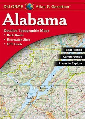
With an incredible wealth of detail, DeLorme's Atlas & Gazetteer is the perfect companion for exploring the Alabama outdoors. Extensively indexed, full-color topographic maps provide information on everything from cities and towns to historic sites, scenic drives, trailheads, boat ramps and even prime fishing spots.
Conveniently bound in book form, the Atlas & Gazetteer is your most comprehensive guide to Alabama's backcountry.
Full-color topographic maps provide information on everything from cities and towns to historic. sites, scenic drives, recreation areas, trailheads, boat ramps and prime fishing spots.
Extensively indexed.
Handy latitude/longitude overlay grid for each map allows you to navigate with GPS.
Inset maps provided for major cities as well as all state lands.
Product Details: Alabama State
Dimensions: 15.5" x 11"
AVAILABLE FOR ALL 50 STATES!
PRP: 123.69 Lei
Acesta este Pretul Recomandat de Producator. Pretul de vanzare al produsului este afisat mai jos.
111.32Lei
111.32Lei
123.69 LeiPrimesti 111 puncte

Indisponibil
Descrierea produsului
With an incredible wealth of detail, DeLorme's Atlas & Gazetteer is the perfect companion for exploring the Alabama outdoors. Extensively indexed, full-color topographic maps provide information on everything from cities and towns to historic sites, scenic drives, trailheads, boat ramps and even prime fishing spots.
Conveniently bound in book form, the Atlas & Gazetteer is your most comprehensive guide to Alabama's backcountry.
Full-color topographic maps provide information on everything from cities and towns to historic. sites, scenic drives, recreation areas, trailheads, boat ramps and prime fishing spots.
Extensively indexed.
Handy latitude/longitude overlay grid for each map allows you to navigate with GPS.
Inset maps provided for major cities as well as all state lands.
Product Details: Alabama State
Dimensions: 15.5" x 11"
AVAILABLE FOR ALL 50 STATES!
Detaliile produsului
De pe acelasi raft
-

PRP: 115.86 Lei
104.27 Lei
104.27 Lei115.86 Lei
-
PRP: 557.68 Lei
501.91 Lei
501.91 Lei557.68 Lei
-
PRP: 247.69 Lei
222.92 Lei
222.92 Lei247.69 Lei
-
PRP: 115.86 Lei
104.27 Lei
104.27 Lei115.86 Lei
-
PRP: 279.00 Lei
251.10 Lei
251.10 Lei279.00 Lei
-
PRP: 111.29 Lei
100.16 Lei
100.16 Lei111.29 Lei
-
PRP: 294.11 Lei
264.70 Lei
264.70 Lei294.11 Lei
-
PRP: 292.85 Lei
263.57 Lei
263.57 Lei292.85 Lei
-
PRP: 263.11 Lei
236.80 Lei
236.80 Lei263.11 Lei
-
PRP: 263.11 Lei
236.80 Lei
236.80 Lei263.11 Lei
-
PRP: 186.00 Lei
167.40 Lei
167.40 Lei186.00 Lei
-
PRP: 247.61 Lei
222.85 Lei
222.85 Lei247.61 Lei
-
PRP: 294.11 Lei
264.70 Lei
264.70 Lei294.11 Lei
-
PRP: 270.86 Lei
243.77 Lei
243.77 Lei270.86 Lei
-
PRP: 263.11 Lei
236.80 Lei
236.80 Lei263.11 Lei
-
PRP: 270.86 Lei
243.77 Lei
243.77 Lei270.86 Lei
De acelasi autor
-
PRP: 55.74 Lei
50.17 Lei
50.17 Lei55.74 Lei
-
PRP: 185.69 Lei
167.12 Lei
167.12 Lei185.69 Lei
-
PRP: 185.69 Lei
167.12 Lei
167.12 Lei185.69 Lei
-
PRP: 185.69 Lei
167.12 Lei
167.12 Lei185.69 Lei
-
PRP: 65.03 Lei
58.53 Lei
58.53 Lei65.03 Lei
-
PRP: 72.26 Lei
65.03 Lei
65.03 Lei72.26 Lei
-
PRP: 180.47 Lei
162.42 Lei
162.42 Lei180.47 Lei
-
PRP: 247.69 Lei
222.92 Lei
222.92 Lei247.69 Lei
-
PRP: 72.26 Lei
65.03 Lei
65.03 Lei72.26 Lei
-
PRP: 72.26 Lei
65.03 Lei
65.03 Lei72.26 Lei
-
PRP: 50.56 Lei
45.50 Lei
45.50 Lei50.56 Lei
-
PRP: 80.54 Lei
72.49 Lei
72.49 Lei80.54 Lei
