headerdesktop mosnick18noi25

MAI SUNT 00:00:00:00

MAI SUNT

X

headermobile mosnick18noi25

MAI SUNT 00:00:00:00

MAI SUNT

X

Family Maps of Pulaski County, Arkansas

De (autor): Gregory A. Boyd J.D

Family Maps of Pulaski County, Arkansas - Gregory A. Boyd J. D.

Family Maps of Pulaski County, Arkansas

De (autor): Gregory A. Boyd J.D

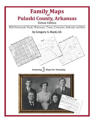
301 pages with 86 total maps Locating original landowners in maps has never been an easy task-until now. This volume in the Family Maps series contains newly created maps of original landowners (patent maps) in what is now Pulaski County, Arkansas, gleaned from the indexes of the U.S. Bureau of Land Management. But it offers much more than that. For each township in the county, there are two additional maps accompanying the patent map: a road map and a map showing waterways, railroads, and both modern and many historical city-centers and cemeteries. Included are indexes to help you locate what you are looking for, whether you know a person's name, a last name, a place-name, or a cemetery. The combination of maps and indexes are designed to aid researchers of American history or genealogy to explore frontier neighborhoods, examine family migrations, locate hard-to-find cemeteries and towns, as well as locate land based on legal descriptions found in old documents or deeds. The patent-maps are essentially plat maps but instead of depicting owners for a particular year, these maps show original landowners, no matter when the transfer from the federal government was completed. Dates of patents typically begin near the time of statehood and run into the early 1900s. What's Mapped in this book (that you'll not likely find elsewhere) . . . 3280 Parcels of Land (with original landowner names and patent-dates labeled in the relevant map) 78 Cemeteries plus . . . Roads, and existing Rivers, Creeks, Streams, Railroads, and Small-towns (including some historical), etc. What YEARS are these maps for? Here are the counts for parcels of land mapped, by the decade in which the corresponding land patents were issued: DecadeParcel-count 1820s298 1830s819 1840s393 1850s314 1860s199 1870s289 1880s439 1890s255 1900s141 1910s116 1920s17 What Cities and Towns are in Pulaski County, Arkansas (and in this book)? Alexander, Alpine, Amboy, Banty (historical), Barger Addition, Base Line, Baucum, Berger, Biddle, Bingham, Blue Hill, Booker, Bredlow Corner, Brittain, Cammack Village, Cannongate Addition, Catorce (historical), Charity (historical), Cloverdale, College Station, Crossroads (historical), Crystal Hill, Dickey (historical), Dixie, Douglas Corner, Douglasville, Estes, Eureka Garden, Fairman, Fairview, Ferndale, Fourche (historical), Galloway, Gap Rancheros, Geyer Springs, Gibson, Gillam Park, Gladewood Addition, Gravel Ridge, Guilford (historical), Gum Springs, Haig, Head (his
Citește mai mult

-20%

transport gratuit

PRP: 270.86 Lei

!

Acesta este Prețul Recomandat de Producător. Prețul de vânzare al produsului este afișat mai jos.

216.69Lei

216.69Lei

270.86 Lei

Primești 216 puncte

Important icon msg

Primești puncte de fidelitate după fiecare comandă! 100 puncte de fidelitate reprezintă 1 leu. Folosește-le la viitoarele achiziții!

Indisponibil

Descrierea produsului

301 pages with 86 total maps Locating original landowners in maps has never been an easy task-until now. This volume in the Family Maps series contains newly created maps of original landowners (patent maps) in what is now Pulaski County, Arkansas, gleaned from the indexes of the U.S. Bureau of Land Management. But it offers much more than that. For each township in the county, there are two additional maps accompanying the patent map: a road map and a map showing waterways, railroads, and both modern and many historical city-centers and cemeteries. Included are indexes to help you locate what you are looking for, whether you know a person's name, a last name, a place-name, or a cemetery. The combination of maps and indexes are designed to aid researchers of American history or genealogy to explore frontier neighborhoods, examine family migrations, locate hard-to-find cemeteries and towns, as well as locate land based on legal descriptions found in old documents or deeds. The patent-maps are essentially plat maps but instead of depicting owners for a particular year, these maps show original landowners, no matter when the transfer from the federal government was completed. Dates of patents typically begin near the time of statehood and run into the early 1900s. What's Mapped in this book (that you'll not likely find elsewhere) . . . 3280 Parcels of Land (with original landowner names and patent-dates labeled in the relevant map) 78 Cemeteries plus . . . Roads, and existing Rivers, Creeks, Streams, Railroads, and Small-towns (including some historical), etc. What YEARS are these maps for? Here are the counts for parcels of land mapped, by the decade in which the corresponding land patents were issued: DecadeParcel-count 1820s298 1830s819 1840s393 1850s314 1860s199 1870s289 1880s439 1890s255 1900s141 1910s116 1920s17 What Cities and Towns are in Pulaski County, Arkansas (and in this book)? Alexander, Alpine, Amboy, Banty (historical), Barger Addition, Base Line, Baucum, Berger, Biddle, Bingham, Blue Hill, Booker, Bredlow Corner, Brittain, Cammack Village, Cannongate Addition, Catorce (historical), Charity (historical), Cloverdale, College Station, Crossroads (historical), Crystal Hill, Dickey (historical), Dixie, Douglas Corner, Douglasville, Estes, Eureka Garden, Fairman, Fairview, Ferndale, Fourche (historical), Galloway, Gap Rancheros, Geyer Springs, Gibson, Gillam Park, Gladewood Addition, Gravel Ridge, Guilford (historical), Gum Springs, Haig, Head (his
Citește mai mult

S-ar putea să-ți placă și

De același autor

Părerea ta e inspirație pentru comunitatea Libris!

Istoricul tău de navigare

Acum se comandă

Noi suntem despre cărți, și la fel este și

Newsletter-ul nostru.

Abonează-te la veștile literare și primești un cupon de -10% pentru viitoarea ta comandă!

*Reducerea aplicată prin cupon nu se cumulează, ci se aplică reducerea cea mai mare.

Mă abonez image one
Mă abonez image one
Accessibility Logo