


Hiking Around Bariloche Map 4 Los Alerces National Park, Esquel, Trevelin, Lago Futalaufquen Complete Trekking/Hiking/Walking Topographic Map Atlas Ar
Hiking Around Bariloche Map 4 Los Alerces National Park, Esquel, Trevelin, Lago Futalaufquen Complete Trekking/Hiking/Walking Topographic Map Atlas Ar
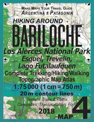
Updated edition. Complete map of the Alerces National Park, a World Heritage Site since 2017, also covering the surroundings of Trevelin and Esquel towns and great walks and wonderful hiking trails in the area.Detailed topographic map 1:75.000 for hiking and trekking, printed as an atlas book (with overlapping pages).
Torrecillas glacier, lakes Futalaufquen, Verde, Krüger, Rivadavia, Menéndez, river Arrayanes etc.
20 meter contour lines, road network, trails & paths, transportation, food, campsites, shelters, guest houses & hotels.Mercator projection with both UTM and WGS84 coordinate grids.
The map scale of 1:75000 (1 cm = 750 meters) provides a wealth of detail while keeping low the weight of the atlas itself. The largepage format of 8.5x11in minimizes page count and along with an overlapping map design allows for comfortable navigation.
The details included in the topographic maps of this atlas were specifically selected to be useful for trekkers, hikers and walkers ofall interests, and make it easy to plan and enjoy both short excursions and hikes as well as long multi-day adventures along themain marked routes and/or adjacent trails and paths, which are also shown on the maps.
With this ultralight atlas you will always have a detailed, reliable, information-rich, battery-independent, shatter-proof map for youradventure.
PRP: 115.86 Lei
Acesta este Prețul Recomandat de Producător. Prețul de vânzare al produsului este afișat mai jos.
104.27Lei
104.27Lei
115.86 LeiPrimești 104 puncte

Livrare in 2-4 saptamani
Descrierea produsului
Updated edition. Complete map of the Alerces National Park, a World Heritage Site since 2017, also covering the surroundings of Trevelin and Esquel towns and great walks and wonderful hiking trails in the area.Detailed topographic map 1:75.000 for hiking and trekking, printed as an atlas book (with overlapping pages).
Torrecillas glacier, lakes Futalaufquen, Verde, Krüger, Rivadavia, Menéndez, river Arrayanes etc.
20 meter contour lines, road network, trails & paths, transportation, food, campsites, shelters, guest houses & hotels.Mercator projection with both UTM and WGS84 coordinate grids.
The map scale of 1:75000 (1 cm = 750 meters) provides a wealth of detail while keeping low the weight of the atlas itself. The largepage format of 8.5x11in minimizes page count and along with an overlapping map design allows for comfortable navigation.
The details included in the topographic maps of this atlas were specifically selected to be useful for trekkers, hikers and walkers ofall interests, and make it easy to plan and enjoy both short excursions and hikes as well as long multi-day adventures along themain marked routes and/or adjacent trails and paths, which are also shown on the maps.
With this ultralight atlas you will always have a detailed, reliable, information-rich, battery-independent, shatter-proof map for youradventure.
Torrecillas glacier, lakes Futalaufquen, Verde, Krüger, Rivadavia, Menéndez, river Arrayanes etc.
20 meter contour lines, road network, trails & paths, transportation, food, campsites, shelters, guest houses & hotels.Mercator projection with both UTM and WGS84 coordinate grids.
The map scale of 1:75000 (1 cm = 750 meters) provides a wealth of detail while keeping low the weight of the atlas itself. The largepage format of 8.5x11in minimizes page count and along with an overlapping map design allows for comfortable navigation.
The details included in the topographic maps of this atlas were specifically selected to be useful for trekkers, hikers and walkers ofall interests, and make it easy to plan and enjoy both short excursions and hikes as well as long multi-day adventures along themain marked routes and/or adjacent trails and paths, which are also shown on the maps.
With this ultralight atlas you will always have a detailed, reliable, information-rich, battery-independent, shatter-proof map for youradventure.
Detaliile produsului


