


John Muir Way Adventure Atlas
John Muir Way Adventure Atlas
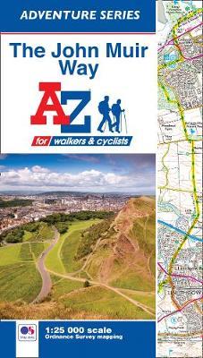
The John Muir Way Adventure Atlas features 54 pages of continuous Ordnance Survey 1:25000 mapping providing complete coverage of both the walking and cycling routes. The book includes a route planner showing distances between places and the amenities available, featuring:
*Information Centres
*Hotels/B&Bs
*Youth Hostels
*Campsites (seasonal opening)
*Public Houses
*Shops
*Restaurants
*Cafes (seasonal opening)
*Petrol Stations
Also featured is advice on safety and security when walking and a selection of QR codes linked to useful websites, including route updates and alerts, regional information, map reading advice and weather reports.
Unlike the original OS sheets, this A-Z Adventure Atlas includes a comprehensive index to towns, villages, hamlets and locations, natural features, nature reserves, car parks and youth hostels, making it easy to find the required location quickly. Each index entry has a page reference and a six figure National Grid Reference. With a book size of 240mm x 134mm it is the same size as the standard OS folded map.
The John Muir Way is a 134 mile (215 km) long-distance footpath in Scotland. Named after the Scottish born conservationist John Muir, this coast to coast route connects Dunbar, his birthplace in the east, with Helensburgh on the west coast, from where he emigrated, aged 10, with his family to America. Crossing Scotland's heartland, the footpath encounters great natural beauty, stunning views and tranquil wild places; sites of historical importance and industrial heritage; grand buildings and impressive engineering; Scotland's historic capital, Edinburgh and coastal towns and villages.
The walking route is highlighted in yellow (which includes handy mileage markers to gauge distances when planning sections of the walk to enjoy), while alternative sections of the cycle route are identified with an orange high
PRP: 60.79 Lei
Acesta este Prețul Recomandat de Producător. Prețul de vânzare al produsului este afișat mai jos.
54.71Lei
54.71Lei
60.79 LeiPrimești 54 puncte
Indisponibil
Descrierea produsului
The John Muir Way Adventure Atlas features 54 pages of continuous Ordnance Survey 1:25000 mapping providing complete coverage of both the walking and cycling routes. The book includes a route planner showing distances between places and the amenities available, featuring:
*Information Centres
*Hotels/B&Bs
*Youth Hostels
*Campsites (seasonal opening)
*Public Houses
*Shops
*Restaurants
*Cafes (seasonal opening)
*Petrol Stations
Also featured is advice on safety and security when walking and a selection of QR codes linked to useful websites, including route updates and alerts, regional information, map reading advice and weather reports.
Unlike the original OS sheets, this A-Z Adventure Atlas includes a comprehensive index to towns, villages, hamlets and locations, natural features, nature reserves, car parks and youth hostels, making it easy to find the required location quickly. Each index entry has a page reference and a six figure National Grid Reference. With a book size of 240mm x 134mm it is the same size as the standard OS folded map.
The John Muir Way is a 134 mile (215 km) long-distance footpath in Scotland. Named after the Scottish born conservationist John Muir, this coast to coast route connects Dunbar, his birthplace in the east, with Helensburgh on the west coast, from where he emigrated, aged 10, with his family to America. Crossing Scotland's heartland, the footpath encounters great natural beauty, stunning views and tranquil wild places; sites of historical importance and industrial heritage; grand buildings and impressive engineering; Scotland's historic capital, Edinburgh and coastal towns and villages.
The walking route is highlighted in yellow (which includes handy mileage markers to gauge distances when planning sections of the walk to enjoy), while alternative sections of the cycle route are identified with an orange high
*Information Centres
*Hotels/B&Bs
*Youth Hostels
*Campsites (seasonal opening)
*Public Houses
*Shops
*Restaurants
*Cafes (seasonal opening)
*Petrol Stations
Also featured is advice on safety and security when walking and a selection of QR codes linked to useful websites, including route updates and alerts, regional information, map reading advice and weather reports.
Unlike the original OS sheets, this A-Z Adventure Atlas includes a comprehensive index to towns, villages, hamlets and locations, natural features, nature reserves, car parks and youth hostels, making it easy to find the required location quickly. Each index entry has a page reference and a six figure National Grid Reference. With a book size of 240mm x 134mm it is the same size as the standard OS folded map.
The John Muir Way is a 134 mile (215 km) long-distance footpath in Scotland. Named after the Scottish born conservationist John Muir, this coast to coast route connects Dunbar, his birthplace in the east, with Helensburgh on the west coast, from where he emigrated, aged 10, with his family to America. Crossing Scotland's heartland, the footpath encounters great natural beauty, stunning views and tranquil wild places; sites of historical importance and industrial heritage; grand buildings and impressive engineering; Scotland's historic capital, Edinburgh and coastal towns and villages.
The walking route is highlighted in yellow (which includes handy mileage markers to gauge distances when planning sections of the walk to enjoy), while alternative sections of the cycle route are identified with an orange high
Detaliile produsului


