


Mid-Wales South Cycle Map
Mid-Wales South Cycle Map
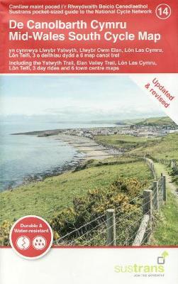
The sparsely populated areas of mid-Wales provide an ideal location for an adventure if you want to get away from the crowds. The coastal areas that surround Cardigan Bay offer great views out to sea, whilst the counties of Ceredigion and Powys afford some challenging gradients as well as a selection of wonderful traffic-free paths.
This revised map to mid-Wales south is in the series of pocket sized, folded maps to the National Cycle Network which include clearly mapped on-road and traffic-free paths, easy to read contours and detailed town insets. The series is published by CycleCity Guides in partnership with Sustrans. 1:110,000 scale; folded 155mm x 99mm; flat 792mm x 630mm.
The Mid-Wales South Cycle Map includes the Ystwyth Trail, Elan Valley Trail, Lon Las Cymru, Lon Teifi, 3 day rides & 6 town centre maps and is now printed on durable, waterproof paper.
PRP: 58.79 Lei
Acesta este Pretul Recomandat de Producator. Pretul de vanzare al produsului este afisat mai jos.
52.91Lei
52.91Lei
58.79 LeiPrimesti 52 puncte

Indisponibil
Descrierea produsului
The sparsely populated areas of mid-Wales provide an ideal location for an adventure if you want to get away from the crowds. The coastal areas that surround Cardigan Bay offer great views out to sea, whilst the counties of Ceredigion and Powys afford some challenging gradients as well as a selection of wonderful traffic-free paths.
This revised map to mid-Wales south is in the series of pocket sized, folded maps to the National Cycle Network which include clearly mapped on-road and traffic-free paths, easy to read contours and detailed town insets. The series is published by CycleCity Guides in partnership with Sustrans. 1:110,000 scale; folded 155mm x 99mm; flat 792mm x 630mm.
The Mid-Wales South Cycle Map includes the Ystwyth Trail, Elan Valley Trail, Lon Las Cymru, Lon Teifi, 3 day rides & 6 town centre maps and is now printed on durable, waterproof paper.
This revised map to mid-Wales south is in the series of pocket sized, folded maps to the National Cycle Network which include clearly mapped on-road and traffic-free paths, easy to read contours and detailed town insets. The series is published by CycleCity Guides in partnership with Sustrans. 1:110,000 scale; folded 155mm x 99mm; flat 792mm x 630mm.
The Mid-Wales South Cycle Map includes the Ystwyth Trail, Elan Valley Trail, Lon Las Cymru, Lon Teifi, 3 day rides & 6 town centre maps and is now printed on durable, waterproof paper.
Detaliile produsului
De pe acelasi raft
-

PRP: 73.22 Lei
65.90 Lei
65.90 Lei73.22 Lei
-
PRP: 145.16 Lei
130.64 Lei
130.64 Lei145.16 Lei
-
PRP: 198.75 Lei
178.88 Lei
178.88 Lei198.75 Lei
-
PRP: 93.67 Lei
84.30 Lei
84.30 Lei93.67 Lei
-
PRP: 167.34 Lei
150.61 Lei
150.61 Lei167.34 Lei
-
PRP: 123.69 Lei
111.32 Lei
111.32 Lei123.69 Lei
-
PRP: 253.17 Lei
227.85 Lei
227.85 Lei253.17 Lei
-
PRP: 115.86 Lei
104.27 Lei
104.27 Lei115.86 Lei
