Countdown header img desk

MAI SUNT 00:00:00:00

MAI SUNT

X

Countdown header img  mob

MAI SUNT 00:00:00:00

MAI SUNT

X

Promotii popup img

-20%-15% la Humanitas

🎃 Weekend cu reduceri

…de groază 👻

Comanda acum >>>

Offa's Dyke Path

De (autor): Anonim

Offa's Dyke Path

Offa's Dyke Path

De (autor): Anonim

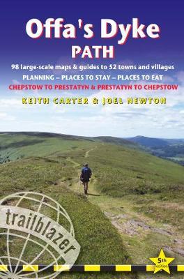
The Offa's Dyke Path is a magnificent National Trail that runs from the North Wales coast to the Severn Estuary following the line of Offa's Dyke, an impressive 8th century earthwork along the English/Welsh border. The ever-changing landscape - the Wye Valley, the Black Mountains, the Shropshire Hills and the Clwydian Hills - is steeped in history and legend providing 177 miles of fascinating walking. This is the 5th edition. * 98 walking maps - 1:20,000 (3-1/8 inches to 1 mile) - the largest-scale maps available. *Unique mapping features - walking times, directions, tricky junctions, places to stay, places to eat, points of interest. * Itineraries for all walkers - whether walking the route in its entirety or sampling the highlights on day walks and short breaks. * Practical information for all budgets - what to see, where to stay, where to eat: pubs, B&Bs, hotels, campsites, hostels. * Guides to 52 towns and villages - along the way * Public transport information - all access points on the path. * GPS waypoints. These are also downloadable from the Trailblazer website. * Includes extra colour sections: 16pp color introduction and 16pp of colour mapping for stage sections (one stage per page) with trail profiles.
Citeste mai mult

-10%

PRP: 103.05 Lei

!

Acesta este Pretul Recomandat de Producator. Pretul de vanzare al produsului este afisat mai jos.

92.75Lei

92.75Lei

103.05 Lei

Primesti 92 puncte

Important icon msg

Primesti puncte de fidelitate dupa fiecare comanda! 100 puncte de fidelitate reprezinta 1 leu. Foloseste-le la viitoarele achizitii!

Indisponibil

Descrierea produsului

The Offa's Dyke Path is a magnificent National Trail that runs from the North Wales coast to the Severn Estuary following the line of Offa's Dyke, an impressive 8th century earthwork along the English/Welsh border. The ever-changing landscape - the Wye Valley, the Black Mountains, the Shropshire Hills and the Clwydian Hills - is steeped in history and legend providing 177 miles of fascinating walking. This is the 5th edition. * 98 walking maps - 1:20,000 (3-1/8 inches to 1 mile) - the largest-scale maps available. *Unique mapping features - walking times, directions, tricky junctions, places to stay, places to eat, points of interest. * Itineraries for all walkers - whether walking the route in its entirety or sampling the highlights on day walks and short breaks. * Practical information for all budgets - what to see, where to stay, where to eat: pubs, B&Bs, hotels, campsites, hostels. * Guides to 52 towns and villages - along the way * Public transport information - all access points on the path. * GPS waypoints. These are also downloadable from the Trailblazer website. * Includes extra colour sections: 16pp color introduction and 16pp of colour mapping for stage sections (one stage per page) with trail profiles.
Citeste mai mult

Detaliile produsului

De acelasi autor

Parerea ta e inspiratie pentru comunitatea Libris!

Istoricul tau de navigare

Acum se comanda

Noi suntem despre carti, si la fel este si

Newsletter-ul nostru.

Aboneaza-te la vestile literare si primesti un cupon de -10% pentru viitoarea ta comanda!

*Reducerea aplicata prin cupon nu se cumuleaza, ci se aplica reducerea cea mai mare.

Ma abonez image one
Ma abonez image one
Accessibility Logo