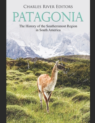
Patagonia: The History of the Southernmost Region in South America

Patagonia: The History of the Southernmost Region in South America
*Includes excerpts of contemporary accounts
*Includes a bibliography for further reading
Patagonia is in the southernmost region of South America, comprising about 400,000 square miles going from the Colorado River in the north to the Tierra del Fuego archipelago in the south. Longitudinally, it covers the whole continental soil, going from the Atlantic shore to the Pacific's waters, including a few islands near the coast, part of the South American plate.
The name, "Patagonia" comes from an observation made by Ferdinand Magellan, who visited the region during his historic expedition around the world. Marveled by the height of the indigenous people, he referred to the region as a "land of giants." Those giants were the Tehuelches, named by Magellan's expedition as Patagones, and the chronicles of that trip, written by Antonio Pigafetta, popularized the term "Patagones," a term that refers to their big feet (in Spanish, "patones" means "of big feet"). This description would later derive in the name Patagonia.
From its discovery until the 20th century, the borders of Patagonia as well as those elements that define it as such have gone through several changes and names. The main thing for understanding its limits during the Spanish conquest is that Patagonia referred to the land south of the European area of influence. Back then, Patagonia was under control of indigenous inhabitants and, as such, outside European control or only partly influenced. It is no wonder, then, that the earliest limit was the Río de la Plata itself, where in 1536 (and again in 1580) the city of Buenos Aires was founded. Later on, the conquest of the territory, along with the work of cartographers from around the world, gave shape to the region.Today, the Patagonian region is politically separated between two countries, Argentina and Chile, as well as by the United Kingdom which controls the Falkland/Malvinas Islands' archipelago. There is also a division made between its two regions: the Cordillera and the steppe (or as it was historically called, "the desert"). The natural boundary between Chile and Argentina is the mountain range of Cordillera de Los Andes.
As a whole, Patagonia has a low population density of only 2.2 inhabitants per square kilometer, and only five percent of the Argentine population resides in Patagonia, with the giant province of Santa Cruz having only 1.4 inhabitants per square kilometer. Some places in Patagonia are among t
PRP: 77.42 Lei
Acesta este Prețul Recomandat de Producător. Prețul de vânzare al produsului este afișat mai jos.
69.68Lei
69.68Lei
77.42 LeiLivrare in 2-4 saptamani
Descrierea produsului
*Includes excerpts of contemporary accounts
*Includes a bibliography for further reading
Patagonia is in the southernmost region of South America, comprising about 400,000 square miles going from the Colorado River in the north to the Tierra del Fuego archipelago in the south. Longitudinally, it covers the whole continental soil, going from the Atlantic shore to the Pacific's waters, including a few islands near the coast, part of the South American plate.
The name, "Patagonia" comes from an observation made by Ferdinand Magellan, who visited the region during his historic expedition around the world. Marveled by the height of the indigenous people, he referred to the region as a "land of giants." Those giants were the Tehuelches, named by Magellan's expedition as Patagones, and the chronicles of that trip, written by Antonio Pigafetta, popularized the term "Patagones," a term that refers to their big feet (in Spanish, "patones" means "of big feet"). This description would later derive in the name Patagonia.
From its discovery until the 20th century, the borders of Patagonia as well as those elements that define it as such have gone through several changes and names. The main thing for understanding its limits during the Spanish conquest is that Patagonia referred to the land south of the European area of influence. Back then, Patagonia was under control of indigenous inhabitants and, as such, outside European control or only partly influenced. It is no wonder, then, that the earliest limit was the Río de la Plata itself, where in 1536 (and again in 1580) the city of Buenos Aires was founded. Later on, the conquest of the territory, along with the work of cartographers from around the world, gave shape to the region.Today, the Patagonian region is politically separated between two countries, Argentina and Chile, as well as by the United Kingdom which controls the Falkland/Malvinas Islands' archipelago. There is also a division made between its two regions: the Cordillera and the steppe (or as it was historically called, "the desert"). The natural boundary between Chile and Argentina is the mountain range of Cordillera de Los Andes.
As a whole, Patagonia has a low population density of only 2.2 inhabitants per square kilometer, and only five percent of the Argentine population resides in Patagonia, with the giant province of Santa Cruz having only 1.4 inhabitants per square kilometer. Some places in Patagonia are among t
Detaliile produsului


