


Philip's Multiscale Europe 2020 A4
Philip's Multiscale Europe 2020 A4
PHILIP'S: THE BEST-SELLING EUROPE ROAD ATLAS RANGE IN THE UK
'The clearest and most detailed maps of Europe' David Williams MBE, CEO Gem Motoring Assist
'The best of its kind with quick, easy-to-use information' Fleet Week
Multiscale mapping - more details where you need it
Special feature for 2020 'Driving Abroad - avoiding the latest pitfalls'
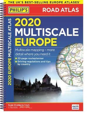
Philip's Multiscale Road Atlas of Europe 2020 has:
- Every country in Europe and Western Europe
- Practical A4 format and spiral-binding - easy to use in the car
- Main scale super-clear 1:750,000 (12 miles to 1 inch)
- 22-page route planning map section with 1,200 miles to a page
- Three supplementary scales from 1:200,000 to 1:3M - helps navigation in denser areas
- 50 town and city plans
- 31 urban area maps
- Scenic routes highlighted
- Driving regulations country-by-country
- Ski resorts feature
- Distance chart
- Fully indexed
In fact, everything you need for your trip to Europe.
'The clearest and most detailed maps of Europe' David Williams MBE, CEO Gem Motoring Assist
'The best of its kind with quick, easy-to-use information' Fleet Week
Multiscale mapping - more details where you need it
Special feature for 2020 'Driving Abroad - avoiding the latest pitfalls'
Philip's Multiscale Road Atlas of Europe 2020 has:
- Every country in Europe and Western Europe
- Practical A4 format and spiral-binding - easy to use in the car
- Main scale super-clear 1:750,000 (12 miles to 1 inch)
- 22-page route planning map section with 1,200 miles to a page
- Three supplementary scales from 1:200,000 to 1:3M - helps navigation in denser areas
- 50 town and city plans
- 31 urban area maps
- Scenic routes highlighted
- Driving regulations country-by-country
- Ski resorts feature
- Distance chart
- Fully indexed
In fact, everything you need for your trip to Europe.
PRP: 92.94 Lei
Acesta este Pretul Recomandat de Producator. Pretul de vanzare al produsului este afisat mai jos.
83.65Lei
83.65Lei
92.94 LeiPrimesti 83 puncte

Indisponibil
Descrierea produsului
PHILIP'S: THE BEST-SELLING EUROPE ROAD ATLAS RANGE IN THE UK
'The clearest and most detailed maps of Europe' David Williams MBE, CEO Gem Motoring Assist
'The best of its kind with quick, easy-to-use information' Fleet Week
Multiscale mapping - more details where you need it
Special feature for 2020 'Driving Abroad - avoiding the latest pitfalls'
Philip's Multiscale Road Atlas of Europe 2020 has:
- Every country in Europe and Western Europe
- Practical A4 format and spiral-binding - easy to use in the car
- Main scale super-clear 1:750,000 (12 miles to 1 inch)
- 22-page route planning map section with 1,200 miles to a page
- Three supplementary scales from 1:200,000 to 1:3M - helps navigation in denser areas
- 50 town and city plans
- 31 urban area maps
- Scenic routes highlighted
- Driving regulations country-by-country
- Ski resorts feature
- Distance chart
- Fully indexed
In fact, everything you need for your trip to Europe.
Detaliile produsului
De pe acelasi raft
-

PRP: 74.34 Lei
66.91 Lei
66.91 Lei74.34 Lei
-
PRP: 253.17 Lei
227.85 Lei
227.85 Lei253.17 Lei
-
PRP: 193.36 Lei
174.02 Lei
174.02 Lei193.36 Lei
-
PRP: 80.29 Lei
72.26 Lei
72.26 Lei80.29 Lei
-
PRP: 213.49 Lei
192.14 Lei
192.14 Lei213.49 Lei
-
PRP: 105.09 Lei
94.58 Lei
94.58 Lei105.09 Lei
-
PRP: 154.69 Lei
139.22 Lei
139.22 Lei154.69 Lei
-
PRP: 54.26 Lei
48.83 Lei
48.83 Lei54.26 Lei
-
PRP: 434.00 Lei
390.60 Lei
390.60 Lei434.00 Lei
-
PRP: 123.69 Lei
111.32 Lei
111.32 Lei123.69 Lei
-
PRP: 135.86 Lei
122.27 Lei
122.27 Lei135.86 Lei
