


Philippines Adventure Travel Map
Philippines Adventure Travel Map
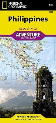
- Waterproof - Tear-Resistant - Travel Map
The Philippines, an archipelago of over 7,000 islands in southeast Asia, offer an extraordinary fusion of cultures and rich biodiversity. National Geographic's Philippines Adventure Map provides global travelers with the perfect combination of detail and perspective in a highly functional travel tool. Each of the three principal geographic divisions of the country ? Luzon, Visayas, and Mindanao ? are detailed. The front side of the print map shows Luzon and includes an inset of the Batanes province. The Visayan Islands, Mindanao, and an inset of the province of Tawi-Tawi are shown on the reverse side.
Cities and towns are easy to find with the map's helpful index. Highways and major roads as well as minor and secondary roads are clearly designated and include distance in kilometers so travelers can easily plan their best route. National parks and reserves, World Heritage sites, hot springs, beaches, points of interest, and areas for surfing and diving are indicated so travelers can take advantage of the Philippines' many natural attractions and activities. The locations of airports, airfields, railroads, and ferry routes take the guesswork out of travel around the islands.
Every Adventure Map is printed on durable synthetic paper, making them waterproof, tear-resistant and tough -- capable of withstanding the rigors of international travel.
- Map Scale = 1:1,300,000
- Sheet Size = 37.75" x 25.5"
- Folded Size = 4.25" x 9.25"
PRP: 101.59 Lei
Acesta este Pretul Recomandat de Producator. Pretul de vanzare al produsului este afisat mai jos.
91.43Lei
91.43Lei
101.59 LeiPrimesti 91 puncte

Indisponibil
Descrierea produsului
- Waterproof - Tear-Resistant - Travel Map
The Philippines, an archipelago of over 7,000 islands in southeast Asia, offer an extraordinary fusion of cultures and rich biodiversity. National Geographic's Philippines Adventure Map provides global travelers with the perfect combination of detail and perspective in a highly functional travel tool. Each of the three principal geographic divisions of the country ? Luzon, Visayas, and Mindanao ? are detailed. The front side of the print map shows Luzon and includes an inset of the Batanes province. The Visayan Islands, Mindanao, and an inset of the province of Tawi-Tawi are shown on the reverse side.
Cities and towns are easy to find with the map's helpful index. Highways and major roads as well as minor and secondary roads are clearly designated and include distance in kilometers so travelers can easily plan their best route. National parks and reserves, World Heritage sites, hot springs, beaches, points of interest, and areas for surfing and diving are indicated so travelers can take advantage of the Philippines' many natural attractions and activities. The locations of airports, airfields, railroads, and ferry routes take the guesswork out of travel around the islands.
Every Adventure Map is printed on durable synthetic paper, making them waterproof, tear-resistant and tough -- capable of withstanding the rigors of international travel.
- Map Scale = 1:1,300,000
- Sheet Size = 37.75" x 25.5"
- Folded Size = 4.25" x 9.25"
Detaliile produsului
De pe acelasi raft
-

PRP: 167.34 Lei
150.61 Lei
150.61 Lei167.34 Lei
-
PRP: 173.54 Lei
156.19 Lei
156.19 Lei173.54 Lei
-
PRP: 256.18 Lei
230.56 Lei
230.56 Lei256.18 Lei
-
PRP: 61.92 Lei
55.73 Lei
55.73 Lei61.92 Lei
-
PRP: 185.93 Lei
167.34 Lei
167.34 Lei185.93 Lei
-
PRP: 234.44 Lei
211.00 Lei
211.00 Lei234.44 Lei
-
PRP: 145.07 Lei
130.56 Lei
130.56 Lei145.07 Lei
-
PRP: 156.65 Lei
140.99 Lei
140.99 Lei156.65 Lei
-
PRP: 99.13 Lei
89.22 Lei
89.22 Lei99.13 Lei
-
PRP: 124.95 Lei
112.45 Lei
112.45 Lei124.95 Lei
-
PRP: 154.94 Lei
139.45 Lei
139.45 Lei154.94 Lei
-
PRP: 185.93 Lei
167.34 Lei
167.34 Lei185.93 Lei
-
PRP: 125.09 Lei
112.58 Lei
112.58 Lei125.09 Lei
-
PRP: 95.06 Lei
85.55 Lei
85.55 Lei95.06 Lei
-
PRP: 92.93 Lei
83.64 Lei
83.64 Lei92.93 Lei
-
PRP: 154.94 Lei
139.45 Lei
139.45 Lei154.94 Lei
-
PRP: 155.00 Lei
139.50 Lei
139.50 Lei155.00 Lei
