Plotting from Above: Enhancing Agricultural Mapping in Asia and the Pacific
Plotting from Above: Enhancing Agricultural Mapping in Asia and the Pacific
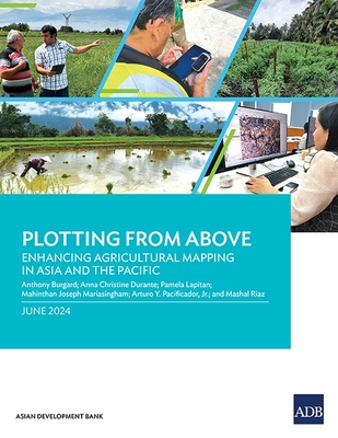
Based on pilot application in Armenia, the Cook Islands, and the Lao People's Democratic Republic, the report outlines four methods to measure agricultural parcels using global positioning systems and assesses the benefits and limitations of each. It also explains some key considerations that statistics offices and line ministries need to consider to maximize how these technologies and tools can inform agricultural policy and planning.
PRP: 248.00 Lei
Acesta este Pretul Recomandat de Producator. Pretul de vanzare al produsului este afisat mai jos.
223.20Lei
223.20Lei
248.00 LeiPrimesti 223 puncte

Livrare in 2-4 saptamani
Descrierea produsului
Based on pilot application in Armenia, the Cook Islands, and the Lao People's Democratic Republic, the report outlines four methods to measure agricultural parcels using global positioning systems and assesses the benefits and limitations of each. It also explains some key considerations that statistics offices and line ministries need to consider to maximize how these technologies and tools can inform agricultural policy and planning.
Detaliile produsului
S-ar putea sa-ti placa si
-
PRP: 165.17 Lei
148.65 Lei
148.65 Lei165.17 Lei
-

PRP: 470.17 Lei
423.15 Lei
423.15 Lei470.17 Lei
-

PRP: 343.58 Lei
309.22 Lei
309.22 Lei343.58 Lei
-
PRP: 290.04 Lei
261.04 Lei
261.04 Lei290.04 Lei
-
PRP: 284.31 Lei
255.88 Lei
255.88 Lei284.31 Lei
-
PRP: 272.00 Lei
244.80 Lei
244.80 Lei272.00 Lei
-
PRP: 348.75 Lei
313.88 Lei
313.88 Lei348.75 Lei
-

PRP: 98.54 Lei
88.69 Lei
88.69 Lei98.54 Lei
-

PRP: 67.93 Lei
61.14 Lei
61.14 Lei67.93 Lei
-

PRP: 215.87 Lei
194.28 Lei
194.28 Lei215.87 Lei
-

PRP: 439.08 Lei
395.17 Lei
395.17 Lei439.08 Lei
-
PRP: 413.33 Lei
372.00 Lei
372.00 Lei413.33 Lei
-
PRP: 347.13 Lei
312.42 Lei
312.42 Lei347.13 Lei