Countdown header img desk

MAI SUNT 00:00:00:00

MAI SUNT

X

Countdown header img  mob

MAI SUNT 00:00:00:00

MAI SUNT

X

Portraying the Land: Hebrew Maps of the Land of Israel from Rashi to the Early 20th Century

Portraying the Land: Hebrew Maps of the Land of Israel from Rashi to the Early 20th Century - Rehav Rubin

Portraying the Land: Hebrew Maps of the Land of Israel from Rashi to the Early 20th Century

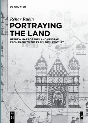
The book presents and discusses a large corpus of Jewish maps of the Holy Land that were drawn by Jewish scholars from the 11th to the 20th century, and thus fills a significant lacuna both in the history of cartography and in Jewish studies. The maps depict the biblical borders of the Holy Land, the allotments of the tribes, and the forty years of wanderings in the desert. Most of these maps are in Hebrew although there are several in Yiddish, Ladino and in European languages. The book focuses on four aspects: it presents an up-to-date corpus of known maps of various types and genres; it suggests a classification of these maps according to their source, shape and content; it presents and analyses the main topics that were depicted in the maps; and it puts the maps in their historical and cultural contexts, both within the Jewish world and the sphere of European cartography of their time. The book is an innovative contribution to the fields of history of cartography and Jewish studies. It is written for both professional readers and the general public. The Hebrew edition (2014), won the Izhak Ben-Zvi Prize.
Citeste mai mult

-10%

transport gratuit

PRP: 247.94 Lei

!

Acesta este Pretul Recomandat de Producator. Pretul de vanzare al produsului este afisat mai jos.

223.15Lei

223.15Lei

247.94 Lei

Primesti 223 puncte

Important icon msg

Primesti puncte de fidelitate dupa fiecare comanda! 100 puncte de fidelitate reprezinta 1 leu. Foloseste-le la viitoarele achizitii!

Indisponibil

Descrierea produsului

The book presents and discusses a large corpus of Jewish maps of the Holy Land that were drawn by Jewish scholars from the 11th to the 20th century, and thus fills a significant lacuna both in the history of cartography and in Jewish studies. The maps depict the biblical borders of the Holy Land, the allotments of the tribes, and the forty years of wanderings in the desert. Most of these maps are in Hebrew although there are several in Yiddish, Ladino and in European languages. The book focuses on four aspects: it presents an up-to-date corpus of known maps of various types and genres; it suggests a classification of these maps according to their source, shape and content; it presents and analyses the main topics that were depicted in the maps; and it puts the maps in their historical and cultural contexts, both within the Jewish world and the sphere of European cartography of their time. The book is an innovative contribution to the fields of history of cartography and Jewish studies. It is written for both professional readers and the general public. The Hebrew edition (2014), won the Izhak Ben-Zvi Prize.
Citeste mai mult

S-ar putea sa-ti placa si

Parerea ta e inspiratie pentru comunitatea Libris!

Istoricul tau de navigare

Acum se comanda

Noi suntem despre carti, si la fel este si

Newsletter-ul nostru.

Aboneaza-te la vestile literare si primesti un cupon de -10% pentru viitoarea ta comanda!

*Reducerea aplicata prin cupon nu se cumuleaza, ci se aplica reducerea cea mai mare.

Ma abonez image one
Ma abonez image one