


Rand McNally Cleveland/Cuyahoga County, Ohio Street Map
Rand McNally Cleveland/Cuyahoga County, Ohio Street Map
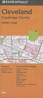
Rand McNally's folded map for Cleveland is a must-have for anyone traveling in and around this part of Ohio, offering unbeatable accuracy and reliability at a great price. Our trusted cartography shows all Interstate, U.S., state, and county highways, along with clearly indicated parks, points of interest, airports, county boundaries, and streets. The easy-to-use legend and detailed index make for quick and easy location of destinations. You'll see why Rand McNally folded maps have been the trusted standard for years.
PRP: 43.33 Lei
Acesta este Pretul Recomandat de Producator. Pretul de vanzare al produsului este afisat mai jos.
39.00Lei
39.00Lei
43.33 LeiPrimesti 38 puncte

Indisponibil
Descrierea produsului
Rand McNally's folded map for Cleveland is a must-have for anyone traveling in and around this part of Ohio, offering unbeatable accuracy and reliability at a great price. Our trusted cartography shows all Interstate, U.S., state, and county highways, along with clearly indicated parks, points of interest, airports, county boundaries, and streets. The easy-to-use legend and detailed index make for quick and easy location of destinations. You'll see why Rand McNally folded maps have been the trusted standard for years.
Detaliile produsului
De pe acelasi raft
-

PRP: 211.42 Lei
190.28 Lei
190.28 Lei211.42 Lei
-
PRP: 123.61 Lei
111.25 Lei
111.25 Lei123.61 Lei
-
PRP: 125.09 Lei
112.58 Lei
112.58 Lei125.09 Lei
-
PRP: 198.33 Lei
178.50 Lei
178.50 Lei198.33 Lei
-
PRP: 256.27 Lei
230.64 Lei
230.64 Lei256.27 Lei
-
PRP: 43.33 Lei
39.00 Lei
39.00 Lei43.33 Lei
-
PRP: 121.63 Lei
109.47 Lei
109.47 Lei121.63 Lei
-
PRP: 152.11 Lei
136.90 Lei
136.90 Lei152.11 Lei
-
PRP: 86.74 Lei
78.07 Lei
78.07 Lei86.74 Lei
-
PRP: 173.60 Lei
156.24 Lei
156.24 Lei173.60 Lei
-
PRP: 55.74 Lei
50.17 Lei
50.17 Lei55.74 Lei
-
PRP: 279.00 Lei
251.10 Lei
251.10 Lei279.00 Lei
-
PRP: 144.89 Lei
130.40 Lei
130.40 Lei144.89 Lei
-
PRP: 433.93 Lei
390.54 Lei
390.54 Lei433.93 Lei
-
PRP: 206.12 Lei
185.51 Lei
185.51 Lei206.12 Lei
-
PRP: 124.00 Lei
111.60 Lei
111.60 Lei124.00 Lei
-
PRP: 254.49 Lei
229.04 Lei
229.04 Lei254.49 Lei
-
PRP: 55.74 Lei
50.17 Lei
50.17 Lei55.74 Lei
De acelasi autor
-
PRP: 55.74 Lei
50.17 Lei
50.17 Lei55.74 Lei
-
PRP: 185.69 Lei
167.12 Lei
167.12 Lei185.69 Lei
-
PRP: 185.69 Lei
167.12 Lei
167.12 Lei185.69 Lei
-
PRP: 65.03 Lei
58.53 Lei
58.53 Lei65.03 Lei
-
PRP: 72.26 Lei
65.03 Lei
65.03 Lei72.26 Lei
-
PRP: 247.69 Lei
222.92 Lei
222.92 Lei247.69 Lei
-
PRP: 72.26 Lei
65.03 Lei
65.03 Lei72.26 Lei
-
PRP: 72.26 Lei
65.03 Lei
65.03 Lei72.26 Lei
-
PRP: 50.56 Lei
45.50 Lei
45.50 Lei50.56 Lei
-
PRP: 80.54 Lei
72.49 Lei
72.49 Lei80.54 Lei
