


Rand McNally Easy to Read! Calfornia State Map
Rand McNally Easy to Read! Calfornia State Map
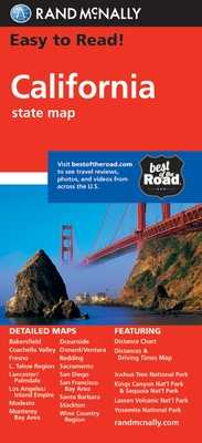
Rand McNally's Easy To Read State Folded Map is a must-have for anyone traveling in and around California, offering unbeatable accuracy and reliability at a great price. Our trusted cartography shows all Interstate, U.S., state, and county highways, along with clearly indicated parks, points of interest, airports, county boundaries, and streets.
The easy-to-use legend and detailed index make for quick and easy location of destinations. You'll see why Rand McNally folded maps have been the trusted standard for years.
Regularly updated, full-color maps.
40% larger map with a bigger type size than the Rand McNally Folded Map.
Clearly labeled Interstate, U.S., state, and county highways.
Indications of parks, points of interest, airports, county boundaries, and more.
Mileage and driving times map.
Detailed index.
Convenient folded size.
Coverage Area
Detailed maps of: Bakersfield, Fresno, Joshua Tree National Park, Kings Canyon Natl Park & Sequoia Natl Park, Lake Tahoe Region, Lancaster/Palmdale, Los Angeles, Modesto, Monterey/Salinas, Oceanside, Oxnard/Ventura, Palm Springs, Sacramento, San Diego
Product Details: State of California
Dimensions (unfolded): 28" x 40". 1 in represents approx. 12.2 miles
PRP: 37.13 Lei
Acesta este Pretul Recomandat de Producator. Pretul de vanzare al produsului este afisat mai jos.
33.42Lei
33.42Lei
37.13 LeiPrimesti 33 puncte

Indisponibil
Descrierea produsului
Rand McNally's Easy To Read State Folded Map is a must-have for anyone traveling in and around California, offering unbeatable accuracy and reliability at a great price. Our trusted cartography shows all Interstate, U.S., state, and county highways, along with clearly indicated parks, points of interest, airports, county boundaries, and streets.
The easy-to-use legend and detailed index make for quick and easy location of destinations. You'll see why Rand McNally folded maps have been the trusted standard for years.
Regularly updated, full-color maps.
40% larger map with a bigger type size than the Rand McNally Folded Map.
Clearly labeled Interstate, U.S., state, and county highways.
Indications of parks, points of interest, airports, county boundaries, and more.
Mileage and driving times map.
Detailed index.
Convenient folded size.
Coverage Area
Detailed maps of: Bakersfield, Fresno, Joshua Tree National Park, Kings Canyon Natl Park & Sequoia Natl Park, Lake Tahoe Region, Lancaster/Palmdale, Los Angeles, Modesto, Monterey/Salinas, Oceanside, Oxnard/Ventura, Palm Springs, Sacramento, San Diego
Product Details: State of California
Dimensions (unfolded): 28" x 40". 1 in represents approx. 12.2 miles
Detaliile produsului
De pe acelasi raft
-

PRP: 50.56 Lei
45.50 Lei
45.50 Lei50.56 Lei
-
PRP: 247.61 Lei
222.85 Lei
222.85 Lei247.61 Lei
-
PRP: 263.11 Lei
236.80 Lei
236.80 Lei263.11 Lei
-
PRP: 294.11 Lei
264.70 Lei
264.70 Lei294.11 Lei
-
PRP: 254.14 Lei
228.73 Lei
228.73 Lei254.14 Lei
-
PRP: 55.74 Lei
50.17 Lei
50.17 Lei55.74 Lei
-
PRP: 65.03 Lei
58.53 Lei
58.53 Lei65.03 Lei
-
PRP: 72.26 Lei
65.03 Lei
65.03 Lei72.26 Lei
-
PRP: 72.26 Lei
65.03 Lei
65.03 Lei72.26 Lei
-
PRP: 72.26 Lei
65.03 Lei
65.03 Lei72.26 Lei
-
PRP: 80.54 Lei
72.49 Lei
72.49 Lei80.54 Lei
-
PRP: 247.69 Lei
222.92 Lei
222.92 Lei247.69 Lei
-
PRP: 144.33 Lei
129.90 Lei
129.90 Lei144.33 Lei
-
PRP: 161.20 Lei
145.08 Lei
145.08 Lei161.20 Lei
De acelasi autor
-
PRP: 55.74 Lei
50.17 Lei
50.17 Lei55.74 Lei
-
PRP: 185.69 Lei
167.12 Lei
167.12 Lei185.69 Lei
-
PRP: 185.69 Lei
167.12 Lei
167.12 Lei185.69 Lei
-
PRP: 185.69 Lei
167.12 Lei
167.12 Lei185.69 Lei
-
PRP: 65.03 Lei
58.53 Lei
58.53 Lei65.03 Lei
-
PRP: 72.26 Lei
65.03 Lei
65.03 Lei72.26 Lei
-
PRP: 180.47 Lei
162.42 Lei
162.42 Lei180.47 Lei
-
PRP: 247.69 Lei
222.92 Lei
222.92 Lei247.69 Lei
-
PRP: 72.26 Lei
65.03 Lei
65.03 Lei72.26 Lei
-
PRP: 72.26 Lei
65.03 Lei
65.03 Lei72.26 Lei
-
PRP: 50.56 Lei
45.50 Lei
45.50 Lei50.56 Lei
-
PRP: 80.54 Lei
72.49 Lei
72.49 Lei80.54 Lei
