The War at Sea 1939-45: Atlas
The War at Sea 1939-45: Atlas
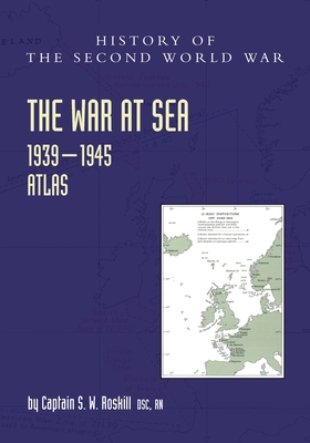
A full gathering together of all 154 valuable maps and diagrams that were bound into Roskill's seminal four-volume Official History of the War at Sea 1939-45. It is an excellent Naval cartography resource covering major and minor actions on the oceans in all theatres of war, including Operation Dynamo, the British evacuations from Dunkirk, and of course the Navy's most critical struggle - the Battle of the Atlantic, defending Britain's vital North American commercial supply lines against U-boat attack - also the Mediterranean, and the freezing Northern routes to Russia, as well as the Pacific Ocean.
The War at Sea, 1939-1945 volumes were originally published from 1954 to 1961 as part of the British Official History series - the History of the Second World War - all edited by J.R.M. Butler. Volume 1: The Defensive, Volume 2: The Period of Balance, Volume 3: The Offensive, Part 1, and Volume 3: The Offensive, Part 2, are all available as text volumes complete with their bound in maps, in both soft and hardbound editions directly from The Naval and Military Press.
At the beginning of World War II, the Royal Navy was the strongest navy in the world, with the largest number of warships built and with naval
bases across the globe. It had over 15 battleships and battlecruisers, 7 aircraft carriers, 66 cruisers, 164 destroyers and 66 submarines. It went on to fight in every theatre from the Atlantic, Mediterranean, freezing Northern routes to Russia and the Pacific Ocean. It was deployed around the world, divided into various fleets and operating from a number of regional stations, also known as commands. The most significant were the Home Fleet based at various stations in the UK, the Mediterranean Fleet based in Alexandria, Egypt, the Eastern Fleet based at both the East Indies Station and China Station, the Pacific Fleet based in Sydney, Australia, the South Atlantic and Africa Station, the America and West Indies Station, and the Western Approaches Station.
PRP: 429.87 Lei
Acesta este Pretul Recomandat de Producator. Pretul de vanzare al produsului este afisat mai jos.
386.88Lei
386.88Lei
429.87 LeiPrimesti 386 puncte

Indisponibil
Descrierea produsului
A full gathering together of all 154 valuable maps and diagrams that were bound into Roskill's seminal four-volume Official History of the War at Sea 1939-45. It is an excellent Naval cartography resource covering major and minor actions on the oceans in all theatres of war, including Operation Dynamo, the British evacuations from Dunkirk, and of course the Navy's most critical struggle - the Battle of the Atlantic, defending Britain's vital North American commercial supply lines against U-boat attack - also the Mediterranean, and the freezing Northern routes to Russia, as well as the Pacific Ocean.
The War at Sea, 1939-1945 volumes were originally published from 1954 to 1961 as part of the British Official History series - the History of the Second World War - all edited by J.R.M. Butler. Volume 1: The Defensive, Volume 2: The Period of Balance, Volume 3: The Offensive, Part 1, and Volume 3: The Offensive, Part 2, are all available as text volumes complete with their bound in maps, in both soft and hardbound editions directly from The Naval and Military Press.
At the beginning of World War II, the Royal Navy was the strongest navy in the world, with the largest number of warships built and with naval
bases across the globe. It had over 15 battleships and battlecruisers, 7 aircraft carriers, 66 cruisers, 164 destroyers and 66 submarines. It went on to fight in every theatre from the Atlantic, Mediterranean, freezing Northern routes to Russia and the Pacific Ocean. It was deployed around the world, divided into various fleets and operating from a number of regional stations, also known as commands. The most significant were the Home Fleet based at various stations in the UK, the Mediterranean Fleet based in Alexandria, Egypt, the Eastern Fleet based at both the East Indies Station and China Station, the Pacific Fleet based in Sydney, Australia, the South Atlantic and Africa Station, the America and West Indies Station, and the Western Approaches Station.
Detaliile produsului
S-ar putea sa-ti placa si
-
PRP: 85.84 Lei
77.26 Lei
77.26 Lei85.84 Lei
-
Fighting ships of World War Two 1937 - 1945. Volume II. United States of America - Alexander Dashyan
PRP: 280.71 Lei
252.64 Lei
252.64 Lei280.71 Lei
-
PRP: 309.69 Lei
278.72 Lei
278.72 Lei309.69 Lei
-
PRP: 479.47 Lei
431.52 Lei
431.52 Lei479.47 Lei
-

PRP: 136.00 Lei
122.40 Lei
122.40 Lei136.00 Lei
-

PRP: 170.00 Lei
153.00 Lei
153.00 Lei170.00 Lei
-
PRP: 330.25 Lei
297.23 Lei
297.23 Lei330.25 Lei
-
PRP: 189.72 Lei
170.75 Lei
170.75 Lei189.72 Lei
-
PRP: 137.95 Lei
124.15 Lei
124.15 Lei137.95 Lei
-

PRP: 204.00 Lei
183.60 Lei
183.60 Lei204.00 Lei
-

PRP: 123.94 Lei
111.55 Lei
111.55 Lei123.94 Lei
-
PRP: 189.72 Lei
170.75 Lei
170.75 Lei189.72 Lei
-
PRP: 77.42 Lei
69.68 Lei
69.68 Lei77.42 Lei
-

PRP: 123.69 Lei
111.32 Lei
111.32 Lei123.69 Lei