Wasatch Eleveners: A Hiking and Climbing Guide to the 11,000 Foot Mountains of Utah's Wasatch Range
Wasatch Eleveners: A Hiking and Climbing Guide to the 11,000 Foot Mountains of Utah's Wasatch Range
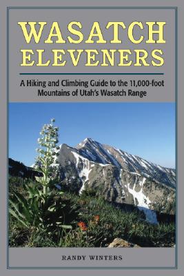
The Wasatch Mountains sit on the western edge of the Rockies. Stretching south through Utah from Bear River in the north to Mount Nebo in the central part of the state, their peaks dominate the skyline of Salt Lake City and nearby urban areas. Elevations range from 9,000 to almost 12,000 feet, with eighteen peaks above 11,000 feet. All of the 11ers can be summited as a day-hike, without the use of climbing gear.
This guide provides information on trailhead access, approaches, and routes for every 11,000-foot peak. It includes overview maps of major roads, topographical overview maps, and detailed route maps for each peak. There are also total roundtrip mileages, elevation-gain (or loss) figures, and alternate routes to help hikers plan their adventures.
Featured peaks include North Mount Nebo, South Mount Nebo, Middle Mount Nebo, Mount Timpanogos, 'South' Timpanogos, West American Fork Twin Peak, 'North' Timpanogos, 'South' American Fork Twin Peak, Unnamed 11,383, Unnamed 11,347, East Broads Fork Twin Peak, West Broads Fork Twin Peak, Pfeifferhorn, White Baldy, Sunrise Peak, Unnamed 11,288, Lone Peak, North Peak, Red Baldy, Red Top Mountain, South Thunder, North Thunder, Unnamed 11,137, Monte Cristo Peak, Dromedary Peak, Box Elder Peak, Mount Baldy, Provo Peak, Sugarloaf Mountain, 'East' Provo Peak, Mount Superior, and 'East' American Fork Twin Peak.
PRP: 92.69 Lei
Acesta este Pretul Recomandat de Producator. Pretul de vanzare al produsului este afisat mai jos.
83.42Lei
83.42Lei
92.69 LeiPrimesti 83 puncte

Livrare in 2-4 saptamani
Descrierea produsului
The Wasatch Mountains sit on the western edge of the Rockies. Stretching south through Utah from Bear River in the north to Mount Nebo in the central part of the state, their peaks dominate the skyline of Salt Lake City and nearby urban areas. Elevations range from 9,000 to almost 12,000 feet, with eighteen peaks above 11,000 feet. All of the 11ers can be summited as a day-hike, without the use of climbing gear.
This guide provides information on trailhead access, approaches, and routes for every 11,000-foot peak. It includes overview maps of major roads, topographical overview maps, and detailed route maps for each peak. There are also total roundtrip mileages, elevation-gain (or loss) figures, and alternate routes to help hikers plan their adventures.
Featured peaks include North Mount Nebo, South Mount Nebo, Middle Mount Nebo, Mount Timpanogos, 'South' Timpanogos, West American Fork Twin Peak, 'North' Timpanogos, 'South' American Fork Twin Peak, Unnamed 11,383, Unnamed 11,347, East Broads Fork Twin Peak, West Broads Fork Twin Peak, Pfeifferhorn, White Baldy, Sunrise Peak, Unnamed 11,288, Lone Peak, North Peak, Red Baldy, Red Top Mountain, South Thunder, North Thunder, Unnamed 11,137, Monte Cristo Peak, Dromedary Peak, Box Elder Peak, Mount Baldy, Provo Peak, Sugarloaf Mountain, 'East' Provo Peak, Mount Superior, and 'East' American Fork Twin Peak.
Detaliile produsului
S-ar putea sa-ti placa si
-
PRP: 154.69 Lei
139.22 Lei
139.22 Lei154.69 Lei
-
PRP: 215.48 Lei
193.93 Lei
193.93 Lei215.48 Lei
-
PRP: 85.17 Lei
76.65 Lei
76.65 Lei85.17 Lei
-
PRP: 145.16 Lei
130.64 Lei
130.64 Lei145.16 Lei
-
PRP: 136.09 Lei
122.48 Lei
122.48 Lei136.09 Lei
-
PRP: 161.14 Lei
145.03 Lei
145.03 Lei161.14 Lei
-

PRP: 189.72 Lei
170.75 Lei
170.75 Lei189.72 Lei
-

PRP: 95.13 Lei
85.62 Lei
85.62 Lei95.13 Lei
-
PRP: 142.29 Lei
128.06 Lei
128.06 Lei142.29 Lei
-
PRP: 61.69 Lei
55.52 Lei
55.52 Lei61.69 Lei
-

PRP: 136.34 Lei
122.71 Lei
122.71 Lei136.34 Lei
-
PRP: 176.21 Lei
158.59 Lei
158.59 Lei176.21 Lei
-
PRP: 490.34 Lei
441.31 Lei
441.31 Lei490.34 Lei
-
PRP: 142.54 Lei
128.29 Lei
128.29 Lei142.54 Lei