Countdown header img desk

MAI SUNT 00:00:00:00

MAI SUNT

X

Countdown header img  mob

MAI SUNT 00:00:00:00

MAI SUNT

X

Promotii popup img

☀️Nu rata!

-50% la 1000 de titluri!😎

Lecturi perfecte de vară

Comandă acum!

Family Maps of Hamilton County, Illinois

Family Maps of Hamilton County, Illinois - Gregory A. Boyd J. D.

Family Maps of Hamilton County, Illinois

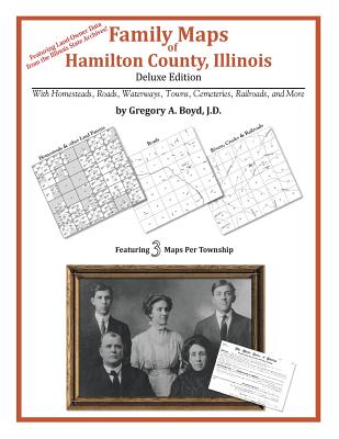
218 pages with 50 total maps Locating original landowners in maps has never been an easy task-until now. This volume in the Family Maps series contains newly created maps of original landowners (patent maps) in what is now Hamilton County, Illinois, gleaned from the indexes of the Illinois State Archives. But it offers much more than that. For each township in the county, there are two additional maps accompanying the patent map: a road map and a map showing waterways, railroads, and both modern and many historical city-centers and cemeteries. Included are indexes to help you locate what you are looking for, whether you know a person's name, a last name, a place-name, or a cemetery. The combination of maps and indexes are designed to aid researchers of American history or genealogy to explore frontier neighborhoods, examine family migrations, locate hard-to-find cemeteries and towns, as well as locate land based on legal descriptions found in old documents or deeds. The patent-maps are essentially plat maps but instead of depicting owners for a particular year, these maps show original landowners, no matter when the transfer from the federal government was completed. Dates of patents typically begin near the time of statehood and run into the early 1900s. What's Mapped in this book (that you'll not likely find elsewhere) . . . 3819 Parcels of Land (with original landowner names and patent-dates labeled in the relevant map) 47 Cemeteries plus . . . Roads, and existing Rivers, Creeks, Streams, Railroads, and Small-towns (including some historical), etc. What YEARS are these maps for? Here are the counts for parcels of land mapped, by the decade in which the patent applications were made: DecadeParcel-count 1810s135 1820s21 1830s570 1840s667 1850s2715 1860s11 1870s3 1890s1 What Cities and Towns are in Hamilton County, Illinois (and in this book)? Aden, Belle Prairie City, Blairsville, Braden, Broughton, Bungay, Cornerville, Dahlgren, Dale, Delafield, Diamond City, Flint, Garrison, Hoodville, Jamestown (historical), Jefferson City (historical), Logansport (historical), Lovilla, McLeansboro, New London (historical), Nipper Corner, Olga, Piopolis, Rectorville (historical), Rural Hill, Thackeray, Thurber, Tuckers Corners, University, Walpole, West Rural Hill
Citeste mai mult

-10%

transport gratuit

PRP: 247.61 Lei

!

Acesta este Pretul Recomandat de Producator. Pretul de vanzare al produsului este afisat mai jos.

222.85Lei

222.85Lei

247.61 Lei

Primesti 222 puncte

Important icon msg

Primesti puncte de fidelitate dupa fiecare comanda! 100 puncte de fidelitate reprezinta 1 leu. Foloseste-le la viitoarele achizitii!

Indisponibil

Descrierea produsului

218 pages with 50 total maps Locating original landowners in maps has never been an easy task-until now. This volume in the Family Maps series contains newly created maps of original landowners (patent maps) in what is now Hamilton County, Illinois, gleaned from the indexes of the Illinois State Archives. But it offers much more than that. For each township in the county, there are two additional maps accompanying the patent map: a road map and a map showing waterways, railroads, and both modern and many historical city-centers and cemeteries. Included are indexes to help you locate what you are looking for, whether you know a person's name, a last name, a place-name, or a cemetery. The combination of maps and indexes are designed to aid researchers of American history or genealogy to explore frontier neighborhoods, examine family migrations, locate hard-to-find cemeteries and towns, as well as locate land based on legal descriptions found in old documents or deeds. The patent-maps are essentially plat maps but instead of depicting owners for a particular year, these maps show original landowners, no matter when the transfer from the federal government was completed. Dates of patents typically begin near the time of statehood and run into the early 1900s. What's Mapped in this book (that you'll not likely find elsewhere) . . . 3819 Parcels of Land (with original landowner names and patent-dates labeled in the relevant map) 47 Cemeteries plus . . . Roads, and existing Rivers, Creeks, Streams, Railroads, and Small-towns (including some historical), etc. What YEARS are these maps for? Here are the counts for parcels of land mapped, by the decade in which the patent applications were made: DecadeParcel-count 1810s135 1820s21 1830s570 1840s667 1850s2715 1860s11 1870s3 1890s1 What Cities and Towns are in Hamilton County, Illinois (and in this book)? Aden, Belle Prairie City, Blairsville, Braden, Broughton, Bungay, Cornerville, Dahlgren, Dale, Delafield, Diamond City, Flint, Garrison, Hoodville, Jamestown (historical), Jefferson City (historical), Logansport (historical), Lovilla, McLeansboro, New London (historical), Nipper Corner, Olga, Piopolis, Rectorville (historical), Rural Hill, Thackeray, Thurber, Tuckers Corners, University, Walpole, West Rural Hill
Citeste mai mult

De acelasi autor

Parerea ta e inspiratie pentru comunitatea Libris!

Istoricul tau de navigare

Acum se comanda

Noi suntem despre carti, si la fel este si

Newsletter-ul nostru.

Aboneaza-te la vestile literare si primesti un cupon de -10% pentru viitoarea ta comanda!

*Reducerea aplicata prin cupon nu se cumuleaza, ci se aplica reducerea cea mai mare.

Ma abonez image one
Ma abonez image one